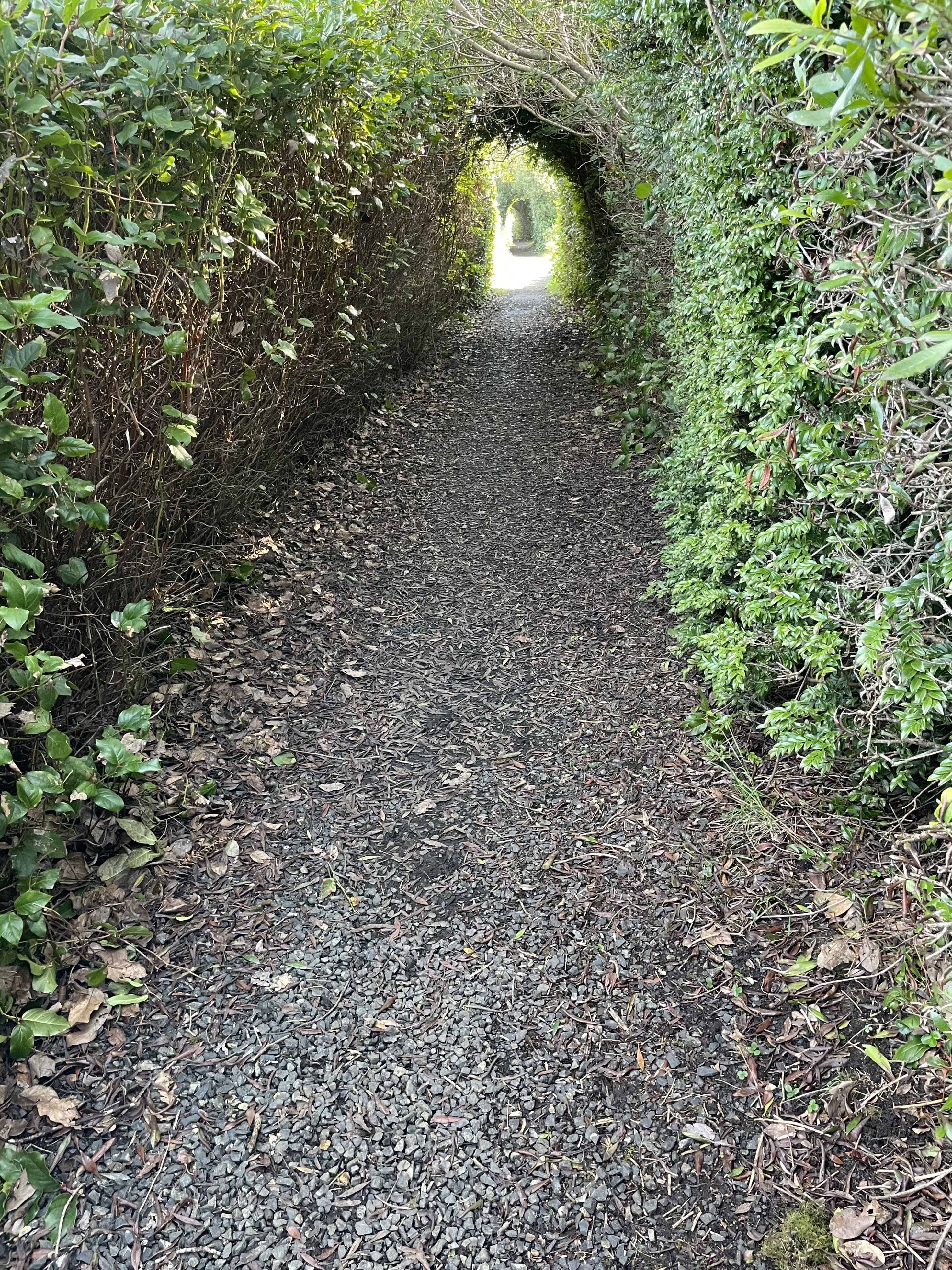
 Above: Walking to the beach at Green Lantern State Park.
 Above: A walk at Perkins Pond.
 We walked about 45 minutes from the car out to the rock.
We were out for about 3 hours with a short break.


 Out to Green Lantern State Park for a 3 hour walk with a short break. We made a loop out to Copalis River Spit & back.
Conner Creek:


 On the trail:


 We were on foot for about two hours.


 Below: Click image once or twice to show detail.
 Circa 1982 daypack:
 Rare WA state park sign:
 We saw several tent campers today at Lake Sylvia State Park.
This was a really great setting and I was very happy to know that tent camping lives on.
The whole area is a throwback to the last century. Love it.
We were out tent camping a few years back.
More here:
Possibly related:
Several years back, I started the Old Man Blog category. It involves thoughts on changes in American culture relating to those born roughly in the late 50s & early 60s.
Original Old Man Blog here: https://oldmanblogdotcom.wordpress.com
New updates here: https://oakbaystarfish.com/category/old-man-blog/


 Craven Rock in the distance:


 Craven Rock
 Marrowstone Point
 Fort Flagler
 River Otter tracks?


 Old dock location:
 Some will remember:

 We were on foot for three hours including a short break.
 Near Craven Rock
 Above: Copalis Rock in the distance.
Looking north across the river to Copalis Beach Airport:

 Copalis River Spit:


 Copalis Rock:

 Just North Of Conner Creek:

 Plenty of lonely beach out there:


 Friday – We walked out from the parking area at the state park.
A really nice late September scene out there.
 Just north of Conner Creek.
We are headed towards Copalis River Spit.
 Friday – We walked out from the parking area at the state park.
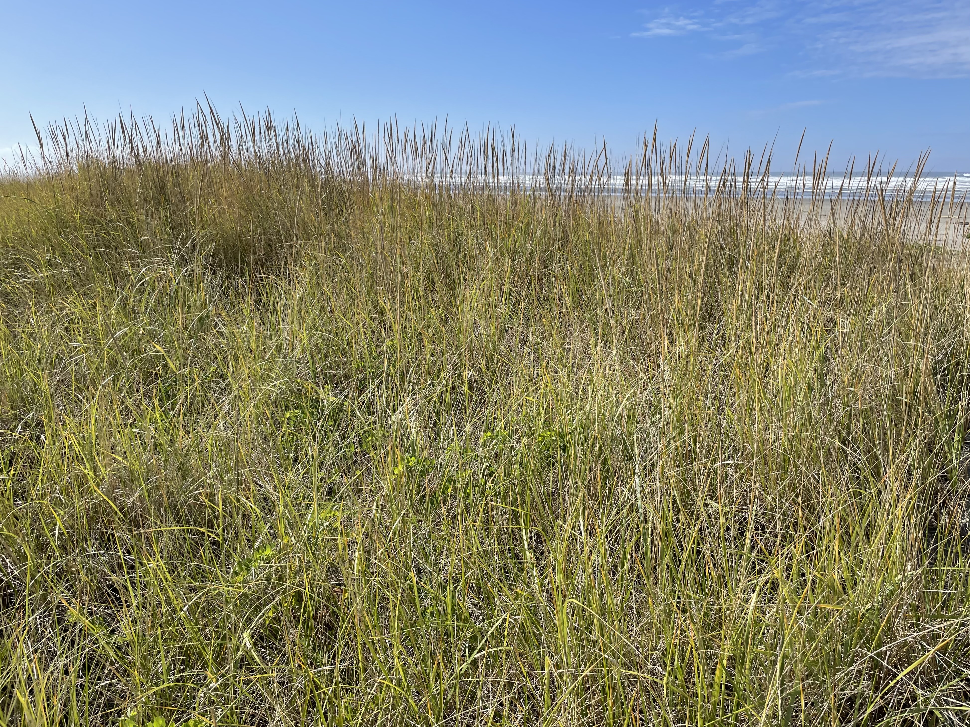
A really nice late September scene out there. We saw a praying mantis in the dune grass on the way back.
 Conner Creek
 A good crop of wild berries next to the trail. These are common in our neighborhood.
Below: Vaccinium ovatum
 Along the Copalis River:

 Looking north across the river to Copalis Beach Airport:
 Copalis Rock in the distance:
 Foggy out there:

 Local info here.


 Above: Conner Creek on Wednesday – We walked out from the parking area at the state park.
Click images once or twice to show detail.
Same location on June 9th:


 June 9, 2025 outing:
 From the state park, we walked out to where the Copalis River contacts Copalis Beach Airport.
The area can feel a bit lonely & remote. This is a plus.
We were on our feet for 2 hours and 41 minutes.
 Westport, WA is a pedestrian-friendly town with easy access to views of the working waterfront.
The Marina
 A genuine seaport town.


 Maritime culture just outside the marina:


Observation Tower
When you’re done at the marina, walk up to the public viewing tower and take a look:
 Detailed information on the tower is here.
The tower has a live web cam showing views in all directions.
A fixed cam at Westport Maritime Museum also shows a view of the marina.
Both cams can be seen here.
Below: A very nice image identifying local coastal features.
Source/credit: City of Westport

The Cove
The Westport Light Trail begins at the base of the observation tower and will take you to the cove.
Walk the cove towards the state park and look for views of an international maritime culture.
An early March 2025 view:
 At the state park, you may continue on the Westport Light Trail all the way south to W Ocean Ave. From there, it’s a short walk to the lighthouse. Google maps shows all of the trail here.
 Look for surfers at the jetty.

 Look for dog friendly beaches south of the jetty.

 Finish up the Westport Light Trail and climb to the top of the lighthouse.

 When you finish at the lighthouse you may head back to the beach on W Ocean Ave.

 Head south for more dog friendly beach and plenty of sand dollars.

 Stay overnight?
Two personal blogs:
Frank Hotels Westport – Good Experience – Again
These folks operate more than one location in town:
Frank Hotels web page is here.
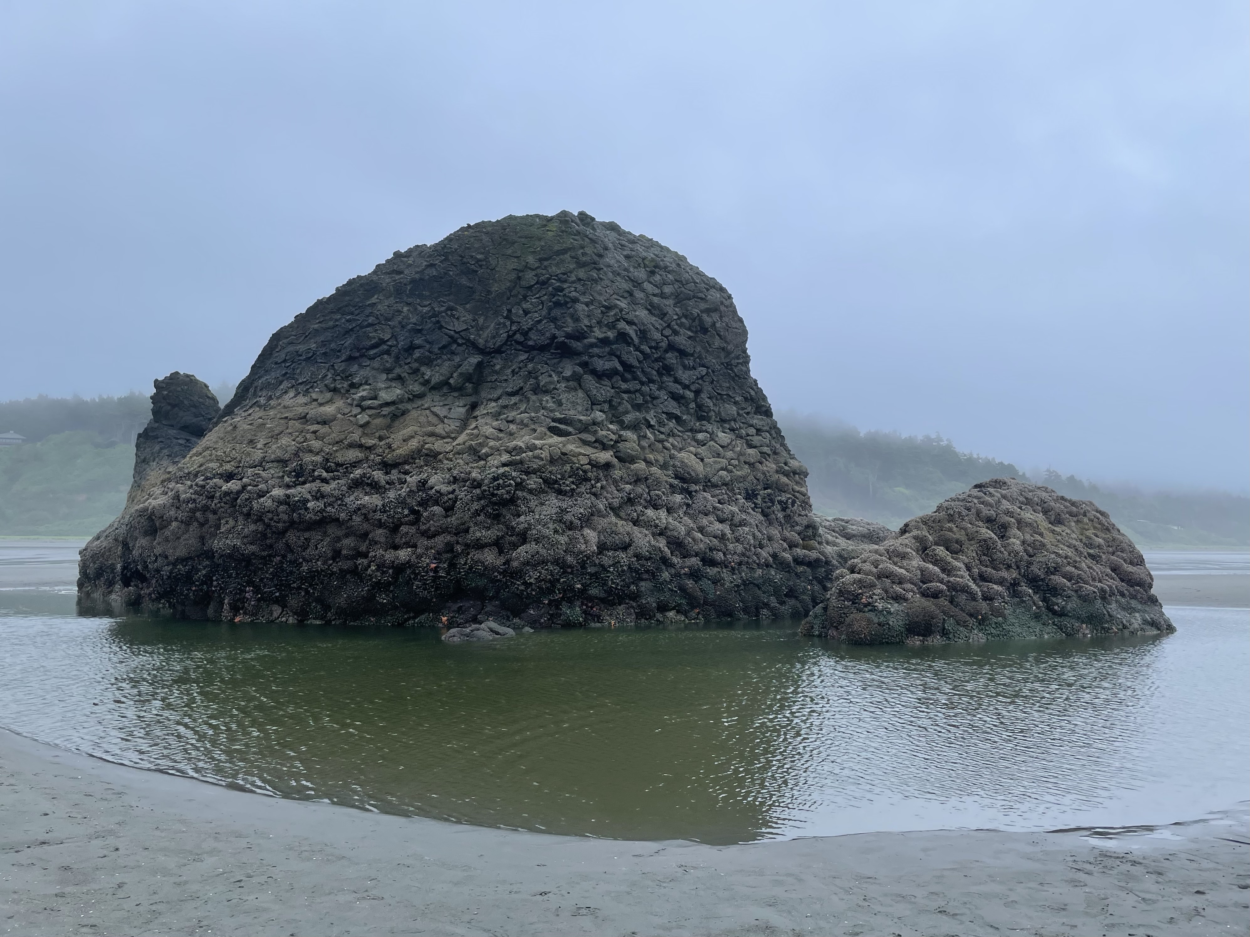 Above: Copalis Rock
We parked near the public access road at Roosevelt Beach and walked out to Copalis Rock and back. We were on foot for about two hours.
We were happy to be able to walk on all sides of the rock.
There was a heavy mist during much of the walk.
We were out recently on June 20th. The weather was drier, but the tide was not as low:
Roosevelt Beach to Copalis River
No sun visible during today’s outing.
 At low tide, there is a scattering of large rocks that are visible on and offshore.


 Heading back:


 Wildlife for today:
We saw a River Otter near the rock. We saw at least one Bald Eagle.
I went out toward the surf and saw something larger than a Harbor Seal swimming near the shore.
Was it a Sea Lion? Was it an Elephant Seal?
Not sure. Here is a look at several possibilities.


 Above: Copalis Rock
We parked near the public access road at Roosevelt Beach and walked out to the river and back. We were on foot for just under three hours.
May be tricky to keep feet dry while crossing Boone Creek.
Dog Friendly
 Nice views of the rocks


 Airport is between Copalis Rock and the river:


 Near the mouth of the Copalis River:
 A really nice walk.
 Earlier this month, we walked out to the south side of the river:
Local info:
Sea Kayak – Copalis River Spit
 From the state park, we walked out to where the Copalis River contacts Copalis Beach Airport.
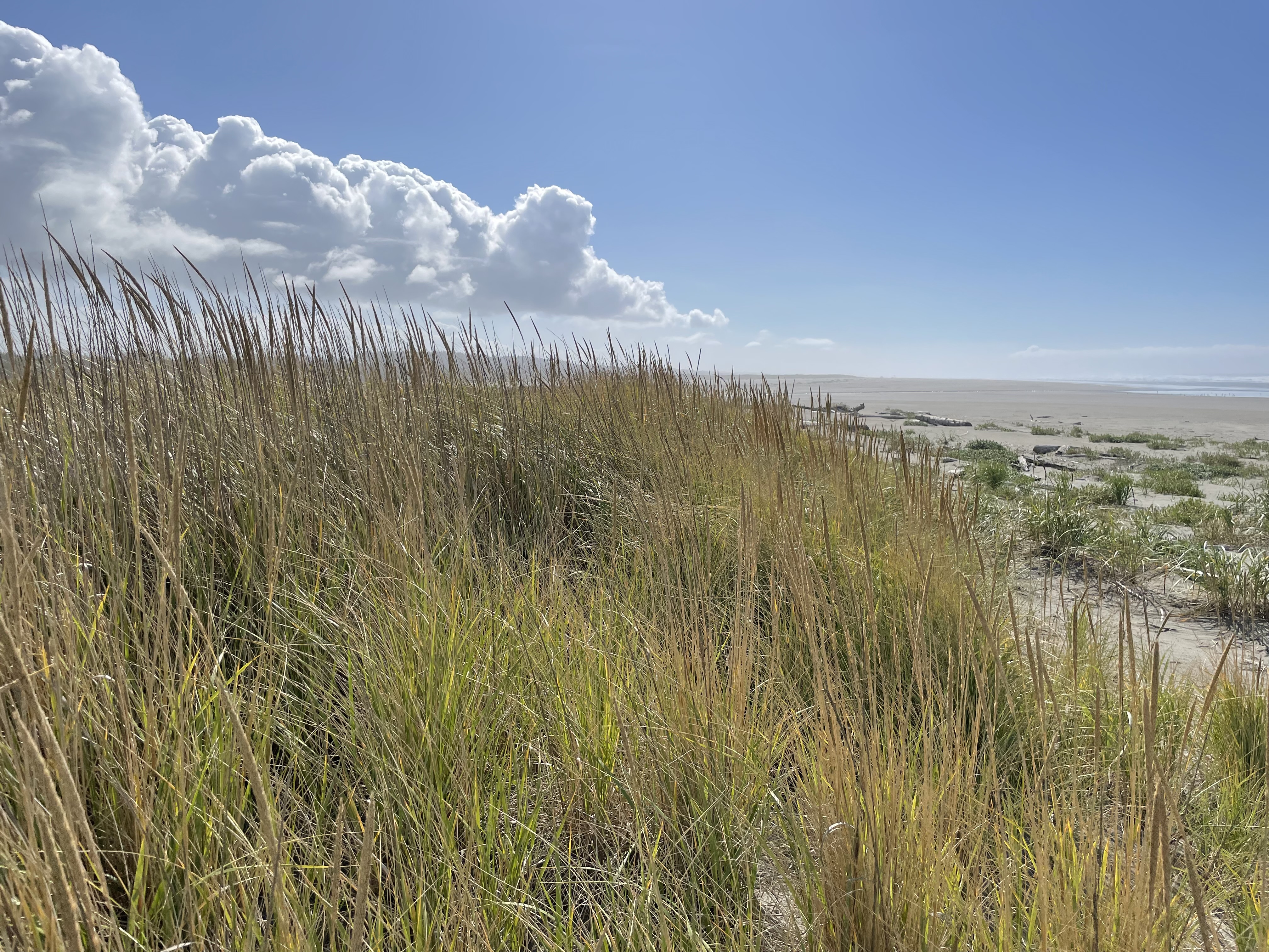
 On the dunes trail:


 Out to a local state park today. It was a nice spot for beachcombing.
Above: A large mussel shell.
Plenty of lonely beach out there.
Along the Copalis River:

 Several years of beachcombing:
 Sept 18, 2025 update:
The old state parks logo above has now been replaced with the new version.
More here: Needs Vs. Wants – $52,500
Out to the park for the first time today. We walked out to where the Copalis River contacts Copalis Beach Airport– image below:
 A nice video of the area here.
We were on our feet for 3 hours and 19 minutes.
Guidebook:
Day Hiking Olympic Peninsula, 2nd Edition
by Craig Romano
A nice spot for beachcombing:

 Trip report:
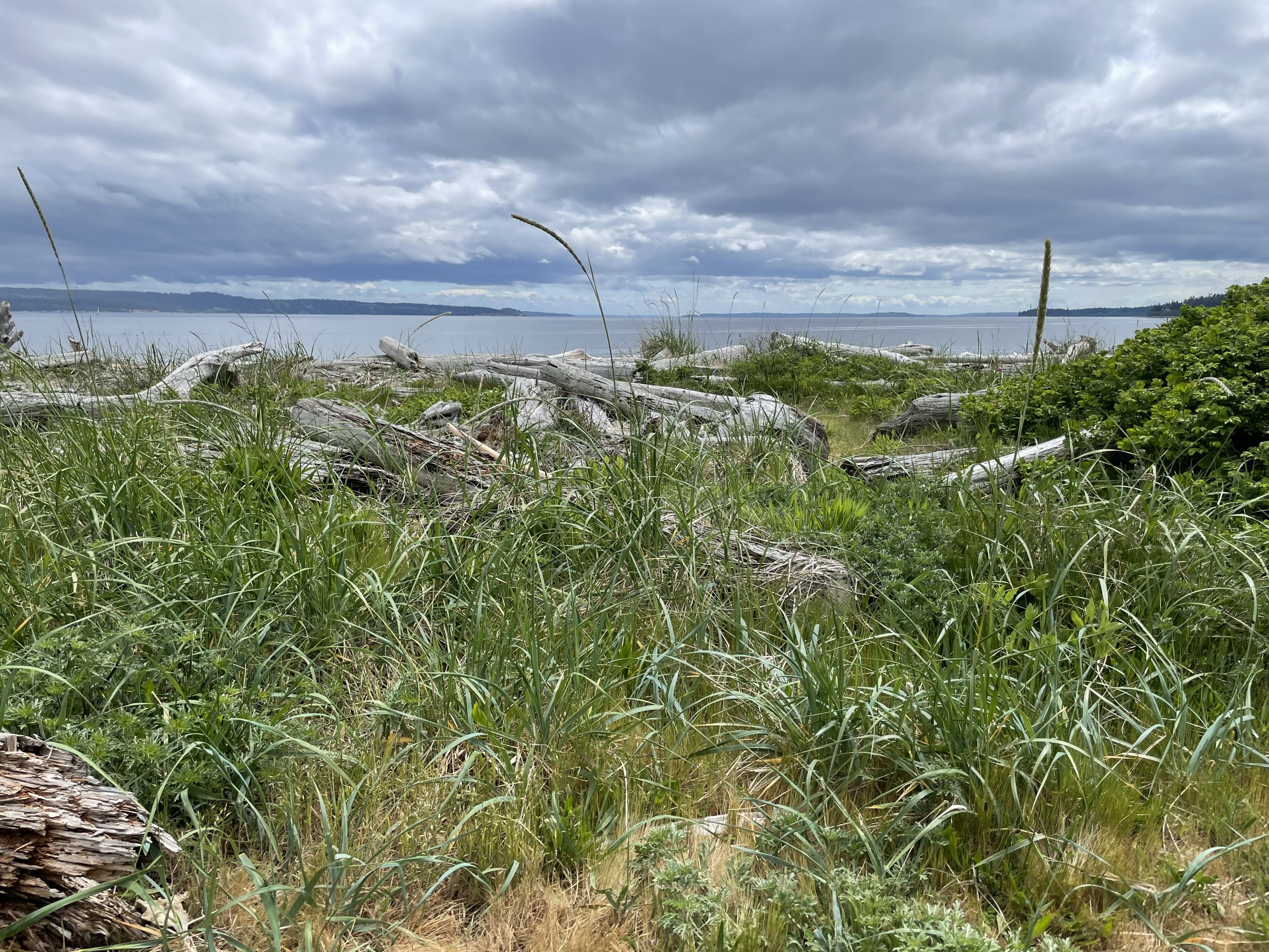
We walked around the north end of the point and towards Port Townsend. We saw a sea lion on the beach and one swimming near the shore. We saw a whale offshore and heard it come up to breathe on occasion for an extended period of time.
Sound was traveling well over the water. We could hear the ship below approaching at a good distance.
 It passed close enough to tell it was flying the flag of Panama.
 Several sites on the web offer info on ship locations.
Ship above is WHISTLER
Click image once or twice to show detail.
Below:
We are looking towards Point Wilson.

 Various small crabs were out and moving over the sand near the rocks.

 Below:
Sea lion can be seen in the upper right and moving to the right.
 Click image once or twice to show detail.

 A variety of rocks and driftwood are part of the scene.
 Approaching the beach:

 Calm & quiet:
 Local history here. More local info here.
Possibly of interest-
Several years of beachcombing:
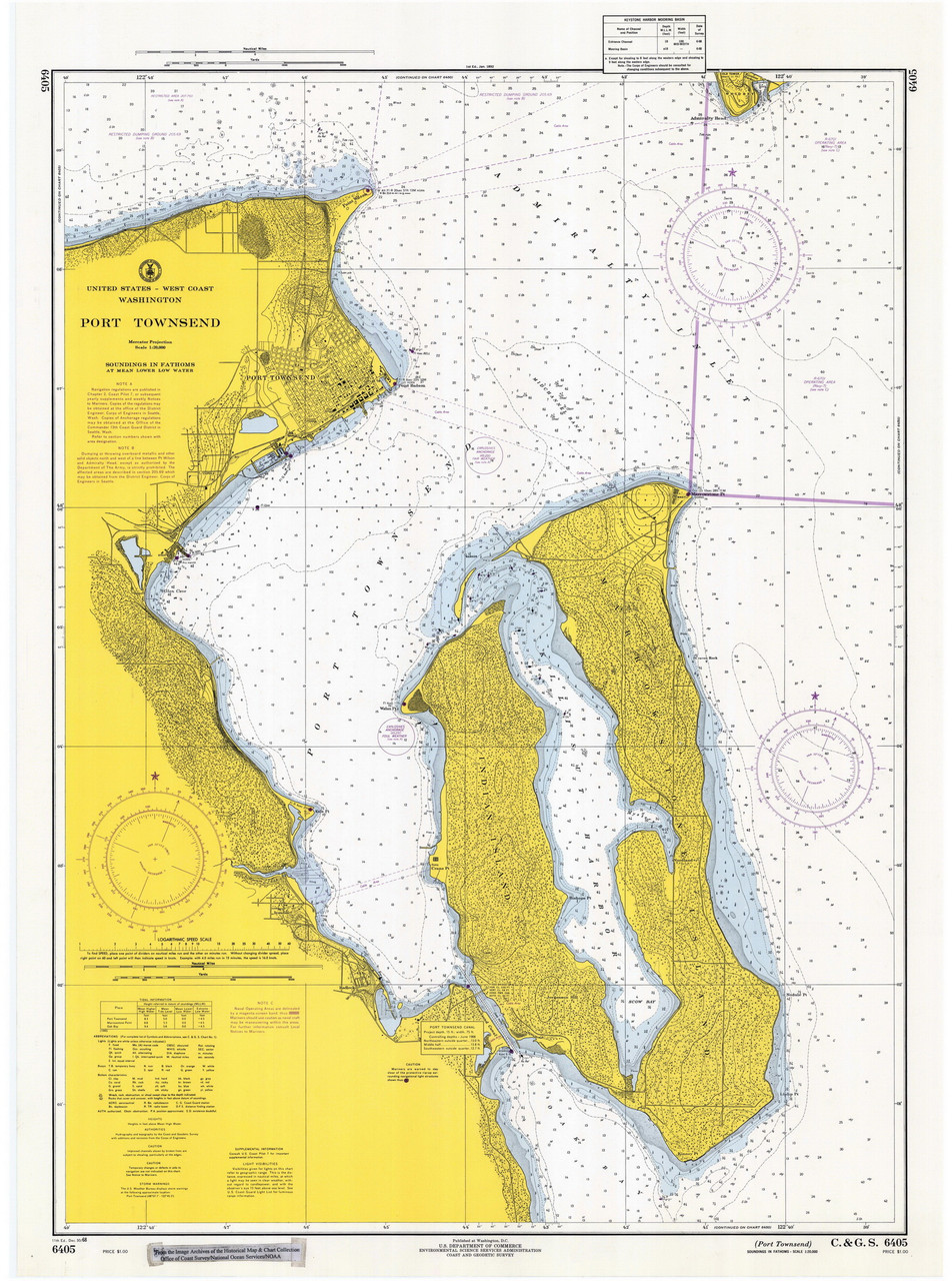
Local papers often use the redundant “Port Townsend Bay” when describing sailing races, etc. at Port Townsend.
The proper name for the body of water is: Port Townsend. Check a navigation chart.
The body of water was named before the town existed.
 Perkins Pond
 Image above: Looking north
This trail runs from the Westport Viewing Tower at Westhaven Drive, south to W Ocean Ave. From there, it’s a short walk to the lighthouse. Google maps shows all of the trail here.
 Looking south:


Adjacent To The Trail


Also:
The Cove
Tallest Lighthouse in Washington
From the Westport Viewing Tower
When the time is right, the top of Mount Rainier is visible from this cam:
Westport – coastal weather cam here.
 Conditions were calm on Saturday. We are looking out to the open ocean here.
Big driftwood is part of the scene.
 Various beach textures out there.
 Looking out to Westport Jetty
 Westport is part of the scene.
 A friendly dog shared part of the walk with us.


 An unusual marker. I am not able to find what the D means.
Click image once or twice to show detail.
 Wildflowers are happy here.

 Big driftwood and the working waterfront at Westport.
 People fishing at the far end of the point.
 Red nun buoy number 4 at the far end of the point.
 Old jetty adjacent to Damon Point public beach access.


 Detailed info on the area here.
Past outings:
We took the tour and walked to the top today. Really enjoyed it and would recommend a visit.
What is it called?
Or, Westport Light:
This excellent history page calls it Grays Harbor Light and Grays Harbor Lighthouse.
We used the parking area beyond the state parks sign above and walked on the paved Westport Light Trail to get to the tallest lighthouse in Washington. Weather was fantastic. Great outing.

 Westport
A very nice image identifying local coastal features.
Source/credit: City of Westport
We used the parking area in the middle of The Cove, then headed out for a nice walk.
Big driftwood, as you arrive at the beach:

 We started by walking towards The Groins. Olympic Mountains in view:


 Waking back towards The Jetty


Several sites on the web offer info on ship locations.
Ship above is DREAM SKY
We continued walking over to the beach south of The Jetty.


 Big driftwood
 A lot of beach out there


 We turned back and walked to our parking spot on the paved Westport Light Trail.
Another chance to get back to the beach:
 Past outings:
When the time is right, the top of Mount Rainier is visible from this cam:
Westport – coastal weather cam here.
Another live cam, just to the south:
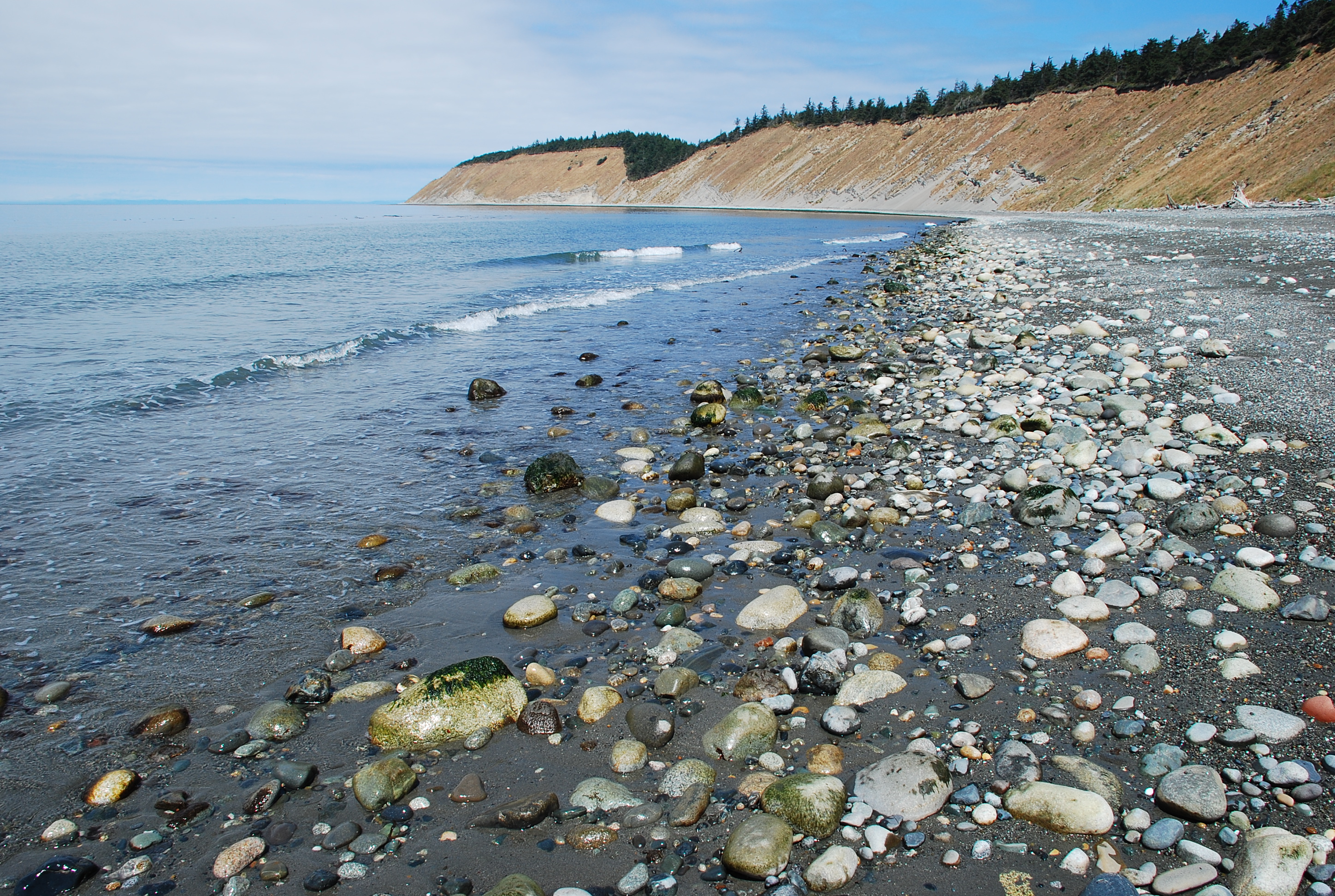
 West and southwest of Penn Cove, two bluff trails offer views of the Olympic Mountains, Admiralty Inlet and the Strait of Juan De Fuca. These two trails are not connected. You must leave one trail to get to the other.
The photo above is taken at Hill Road. The Ebey’s Landing Bluff Trail runs along the high ground in the distance. Further north is the Fort Ebey Bluff Trail.
Fort Ebey State Park Bluff Trail
You can park near the beach at Fort Ebey and access the trail just next to the parking area. Before starting the hike, I like to take a look at what’s happening at the beach. This trail runs through brushy areas towards the high ground. I’ve never seen Salal this tall anywhere else.

Soon after starting the hike you will be above Point Partridge, where you can get a look at the water from the site of the navigation marker. A line from Point Partridge to Point Wilson is the eastern boundary of the Strait of Juan De Fuca. To the south is Admiralty Inlet. Further ahead you will break out into an open area where the old gun emplacements are situated.


People who want to skip the hike can drive up and park here.
An offseason view:

You are on level ground now and can continue south until you get to the group camp site. On past the old site of the gun emplacements, the trail runs near a campground which is closed in winter. Not quite sure why local state parks at sea level are closed in winter.
Watch your step here.
There are some great views from here on up to the group camp site.


Here is a look at the north end of Perego’s Lagoon and Camp Casey in the distance:

You can continue past the group camp to the Cedar Hollow Trail. I like to head down a short ways and look out at the water where the trail comes to a low point closer to the beach. This spot is easily visible from miles away. You can spot it by looking for the spot where the woods meet the bluff at a low point. This is where I turn back.
Wrap up-
Fort Ebey is a multi-use area that connects to a large network of woodsy trails. Fort Ebey features a really cool group camp site and a wooded public campground that is open during part of the year.
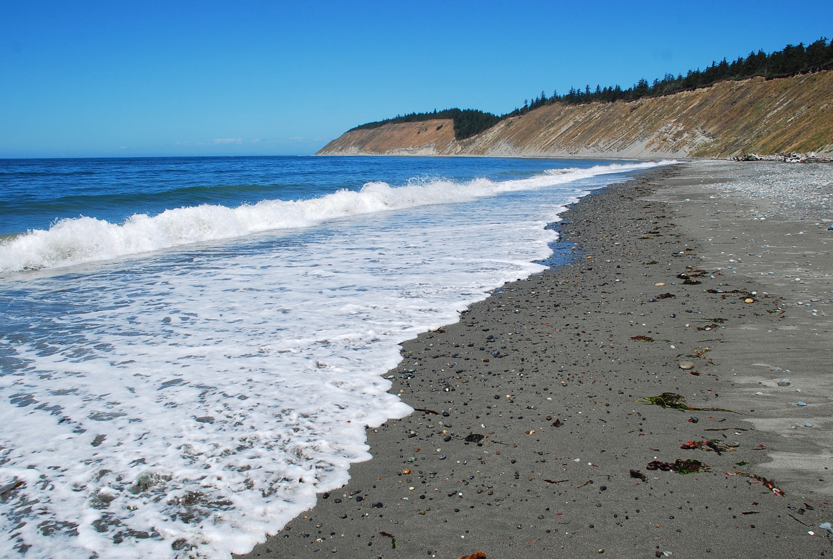
When the time is right, look for surfers at Point Partridge. Footing can be tricky while walking the beach south of Point Partridge because of the large rocks that make up this part of the beach.

A couple of times, I have walked south from here to Perego’s Lagoon. That’s some lonely beach out there.
For decent footing, a better walk is to head north on the beach until you arrive at Libbey Beach County Park.
Fort Ebey features two paved roads that run up hill. One stays inside the little ranger station/shack at the park entrance and takes you up to the gun emplacements and camp ground site. The other road runs uphill outside of the ranger station gate and takes you towards the group camp and a little beyond to a parking area near an entrance to the Cedar Hollow Trail. Both of these roads are great for uphill walking when you want to get into a stride and not have to concentrate as much on uphill trail footing.
Fort Ebey also includes Lake Pondilla, not far from the surf. Listen for the Point Partridge bell buoy on days with any wave action.
The Fort Ebey Bluff Trail is a place where it’s possible to go without seeing any other people during some parts of the year.
Relevant links:
Ebey’s Landing Bluff Trail
You can start this hike from the beach at Ebey’s Landing State Park, or from the Prairie Overlook parking area near Sunnyside Cemetery. This is the more popular of the bluff trails and you are sure to see more people here. This hike features big views of Whidbey agriculture and both the Olympic and Cascade mountain ranges.
If you start from the Prairie Overlook, the first part of the hike takes you out towards the beach. Caution-this trail may become muddy & slick during winter and early spring. Footing can be tricky.

The trail continues west, then quickly leads to higher ground. This is a good spot to stop and take a look towards the south.


Now it’s time to start moving north along the high ground next to busy shipping lanes.

Not far ahead, you will begin to see the south end of Perego’s Lagoon.


The trail continues along the bluff until you are above the north end of Perego’s Lagoon. This is a good spot to look north toward Fort Ebey.

Going any further takes you down towards the beach.

You may want to return on the trail or walk on the beach to get back to where you started. Check the tides to make sure the beach will remain dry.
I’ve made the return trip on the beach and on the trail. This is a good beach for walking.
Walking along Perego’s Lagoon
Looking south:

Looking north:

The views are great if you head back on the trail.

Wrap up-
The Ebey’s Landing Bluff Trail is part of a day use area. You’re sure to see others here. There are two places to start this hike. It’s a great outing whether you return on the beach or the trail. Watch the tides if you are headed back on the beach.
Relevant links:
Whidbey Island – Ebey’s Landing
Worth the Trip: Soul-nourishing vistas at Ebey’s Landing
These areas make for great outings all year round.
See you out there.
Occasionally on adjacent beaches:


