Image source/credit: The Web
Image source/credit: The Web
 Trip report:
We went out and parked at the Heath Road beach access.
 We entered the beach, then turned and walked north. Nobody was there when we arrived.
A ways up, we came to this sign:
 Beachcombing can be more interesting in areas where vehicles are not present.
 Tracks leading to the water:
 We walked up to Connor Creek.
The high ground next to the creek is near the state park trail where we walked on Friday to reach Copalis River Spit.
 Where Connor Creek meets the Pacific Ocean:

 Happy Hours
 Happy Hours – Out and about with dogs in the PNW.
The collection is here.


 From the state park, we walked out to where the Copalis River contacts Copalis Beach Airport.
 On the dunes trail:


 Sept 18, 2025 update:
The old state parks logo above has now been replaced with the new version.
More here: Needs Vs. Wants – $52,500
Out to the park for the first time today. We walked out to where the Copalis River contacts Copalis Beach Airport– image below:
 A nice video of the area here.
We were on our feet for 3 hours and 19 minutes.
Guidebook:
Day Hiking Olympic Peninsula, 2nd Edition
by Craig Romano
A nice spot for beachcombing:

 Perkins Pond
 Local info: Garden By The Sea
 Above: Seen on the Weatherwax trails.
Below: Seen on a beach walk south of Shilo Inn/Chance A La Mer.
This one did not appear to be staged.
 Below: Seen at Oyhut Wildlife Recreation Area.


 Click images once or twice to show detail.
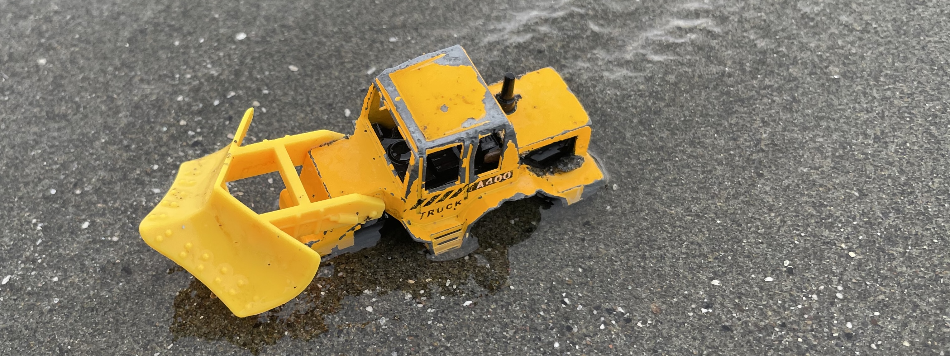
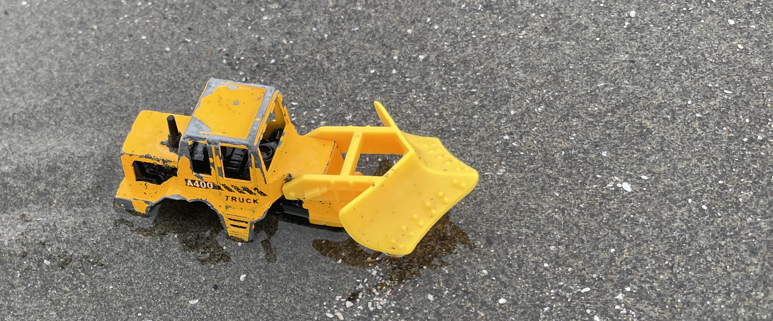
 Was passing along a local trail and came upon this scene.
Credit to the creative imagination of others.
 Adjacent to Bowerman Airport, the Sandpiper Trail, is where we spent part of the afternoon on Tuesday.
Local info here.
 Adjacent to Bowerman Airport, the Sandpiper Trail, is where we spent part of the afternoon on Tuesday.
Local info here.
 Adjacent to Bowerman Airport, the Sandpiper Trail, is where we spent part of the afternoon on Tuesday.
Local info here.
 Adjacent to Bowerman Airport, the Sandpiper Trail, is where we spent part of the afternoon on Tuesday. Click image above once or twice to show detail.
Local info here.
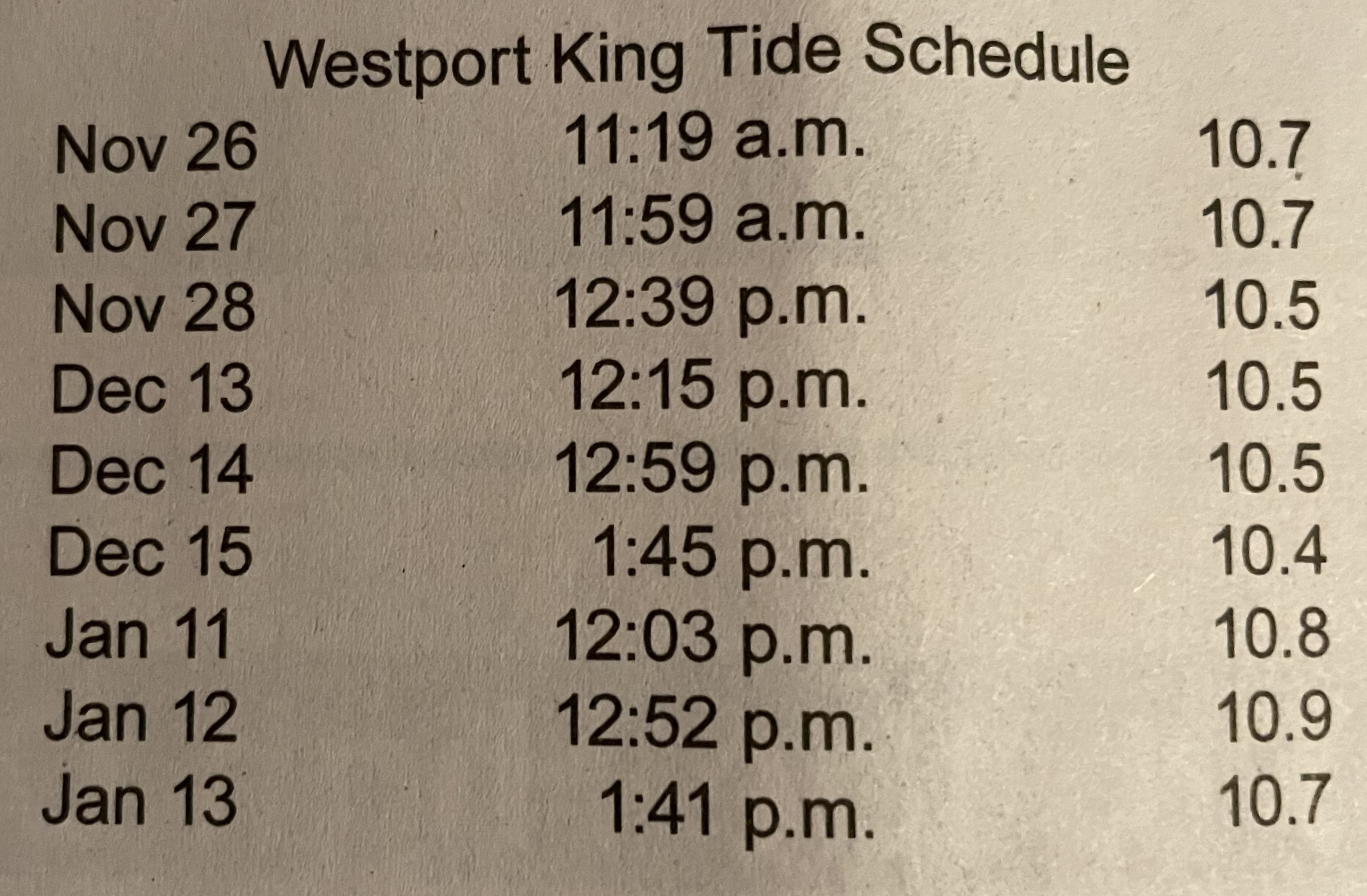 Image above:
Posted in the recent edition of The Ocean Observer top of page B-2
A favorite tide data page here.
When the time is right, the top of Mount Rainier is visible from this cam:
Westport – coastal weather cam here.
Possibly of interest:
98569 Coastal Erosion Attitudes
 Probably 20 years back.
 Mystery Bay
 Much history (town of Ocosta) here.


Old Pilings


 An excellent blog with local info – posted here with permission:
Bottle Beach State Park – state parks quest #14


 Washington Coast – The North Beach

Out to North Jetty on a fantastic January day.

Looking over towards Westport. The ship here is CORAL GEM.
Several sites on the web offer info on ship locations.
Click image once or twice to show detail.

Mount Rainier


Washington Coast
 A few hours of dry weather on Tuesday. This trail was well sheltered from the wind.
Local info here.