
North end of Perego’s Lagoon.
Local info:
 Daytime beach walks are back.
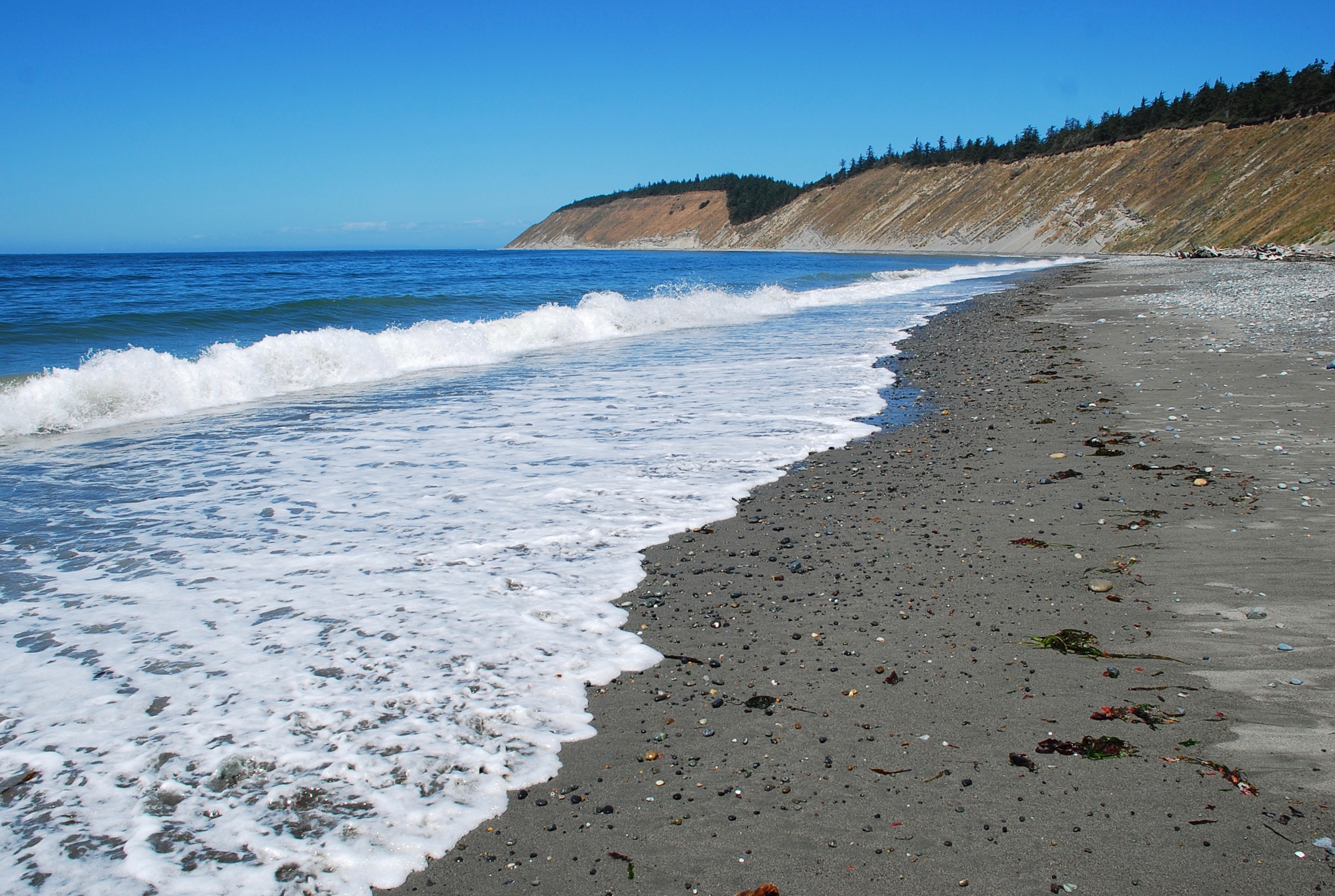
 A view from the beach at Ebey’s Landing.
Protection Island and the Olympic Mountains in the distance.
 On the Ebey’s Landing Bluff Trail.
Busy shipping lanes and the Olympic Mountains:

Local info:

Ebey’s Landing Bluff Trail:
Starting from the Prairie Overlook parking area near, Sunnyside Cemetery, the first part of the hike takes you out towards the beach.
Caution-this trail may become muddy & slick during winter and early spring. Footing can be tricky.
More here:
 Love walking the local trails all year round.
Ebey’s Landing Bluff Trail:
If you start from the Prairie Overlook parking area near, Sunnyside Cemetery, the first part of the hike takes you out towards the beach.
Caution-this trail may become muddy & slick during winter and early spring. Footing can be tricky.
More here:
 Just north of Perego’s Lagoon on Monday.
The Ebey’s Landing Bluff Trail will take you there. I walked out from the cemetery.
 More about the area: Two Bluff Trails
 More about the area: Two Bluff Trails
 Ebey’s Bluff Trail Loop
 More about the area: Two Bluff Trails
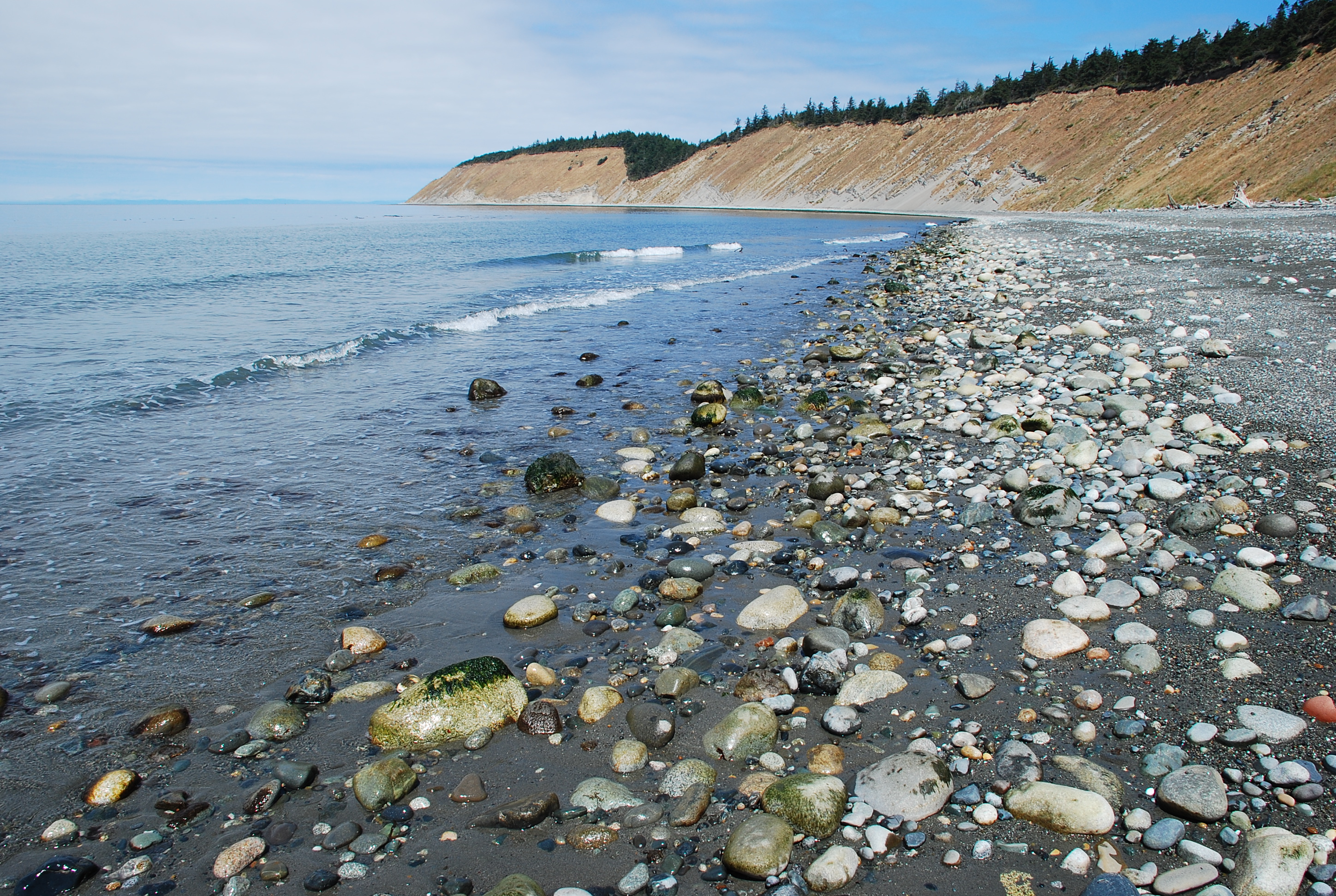
 Looking north towards Perego’s Lagoon.
How to get there: Two Bluff Trails
 More here: Two Bluff Trails
 A view from the Bluff Trail

Coupeville
Same spot in 2016: Flooded field – Coupeville
Yearly rain: 4.38 in. (YTD)
YTD Rain Last Year: 1.39 in.
 Coupeville
Same spot in 2016: Flooded field – Coupeville
Yearly rain: 4.38 in. (YTD)
YTD Rain Last Year: 1.39 in.
 Today I parked near the cemetery and walked the Ridge Trail west until I came to the bluff.
The Bluff Trail is a friendly place. Several others were out enjoying a dry and slightly breezy afternoon.


North end of Perego’s Lagoon

Remnants of a wind blasted tree

Whidbey Agriculture

Related: Two Bluff Trails
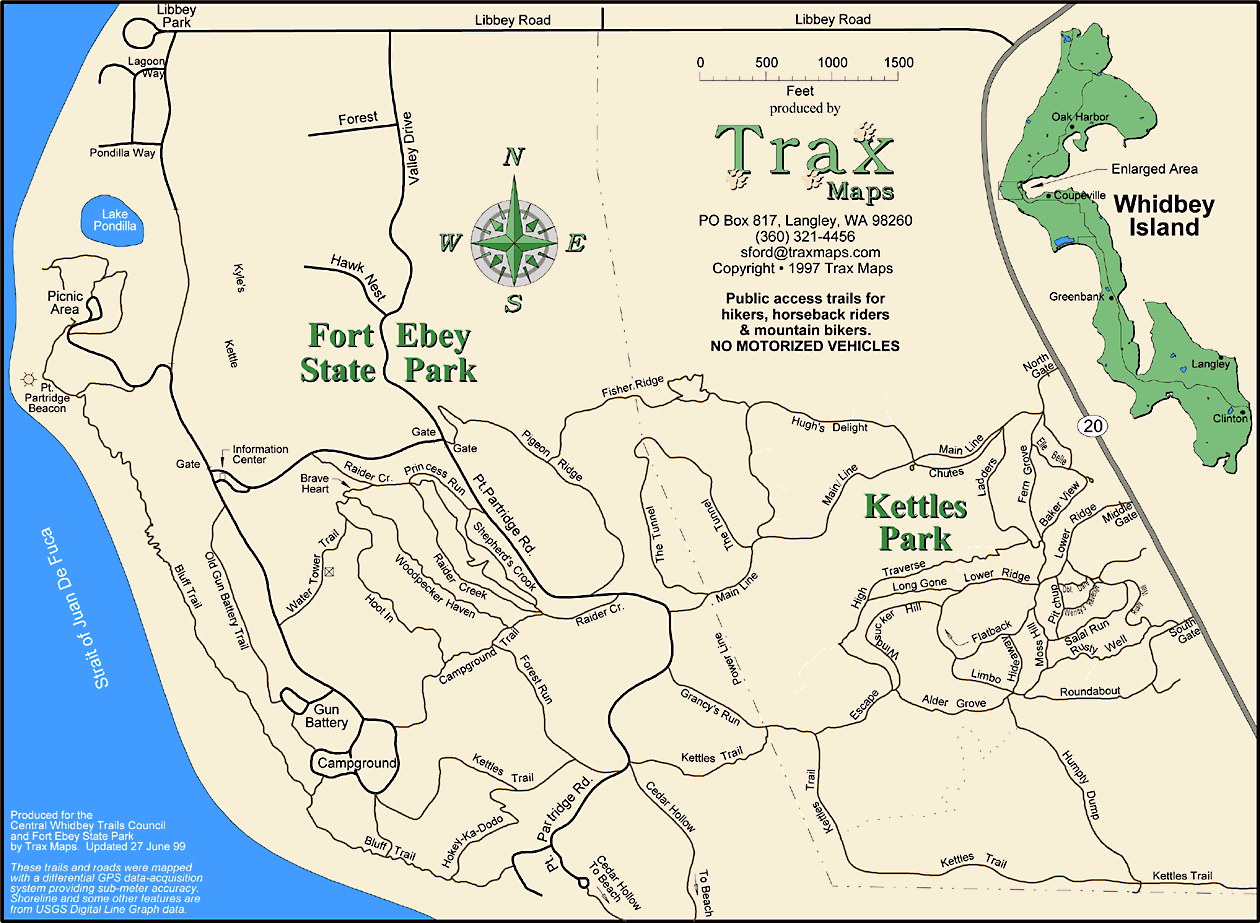
 West and southwest of Penn Cove, two bluff trails offer views of the Olympic Mountains, Admiralty Inlet and the Strait of Juan De Fuca. These two trails are not connected. You must leave one trail to get to the other.
The photo above is taken at Hill Road. The Ebey’s Landing Bluff Trail runs along the high ground in the distance. Further north is the Fort Ebey Bluff Trail.
Fort Ebey State Park Bluff Trail
You can park near the beach at Fort Ebey and access the trail just next to the parking area. Before starting the hike, I like to take a look at what’s happening at the beach. This trail runs through brushy areas towards the high ground. I’ve never seen Salal this tall anywhere else.

Soon after starting the hike you will be above Point Partridge, where you can get a look at the water from the site of the navigation marker. A line from Point Partridge to Point Wilson is the eastern boundary of the Strait of Juan De Fuca. To the south is Admiralty Inlet. Further ahead you will break out into an open area where the old gun emplacements are situated.


People who want to skip the hike can drive up and park here.
An offseason view:

You are on level ground now and can continue south until you get to the group camp site. On past the old site of the gun emplacements, the trail runs near a campground which is closed in winter. Not quite sure why local state parks at sea level are closed in winter.
Watch your step here.
There are some great views from here on up to the group camp site.


Here is a look at the north end of Perego’s Lagoon and Camp Casey in the distance:

You can continue past the group camp to the Cedar Hollow Trail. I like to head down a short ways and look out at the water where the trail comes to a low point closer to the beach. This spot is easily visible from miles away. You can spot it by looking for the spot where the woods meet the bluff at a low point. This is where I turn back.
Wrap up-
Fort Ebey is a multi-use area that connects to a large network of woodsy trails. Fort Ebey features a really cool group camp site and a wooded public campground that is open during part of the year.
When the time is right, look for surfers at Point Partridge. Footing can be tricky while walking the beach south of Point Partridge because of the large rocks that make up this part of the beach.

A couple of times, I have walked south from here to Perego’s Lagoon. That’s some lonely beach out there.
For decent footing, a better walk is to head north on the beach until you arrive at Libbey Beach County Park.
Fort Ebey features two paved roads that run up hill. One stays inside the little ranger station/shack at the park entrance and takes you up to the gun emplacements and camp ground site. The other road runs uphill outside of the ranger station gate and takes you towards the group camp and a little beyond to a parking area near an entrance to the Cedar Hollow Trail. Both of these roads are great for uphill walking when you want to get into a stride and not have to concentrate as much on uphill trail footing.
Fort Ebey also includes Lake Pondilla, not far from the surf. Listen for the Point Partridge bell buoy on days with any wave action.
The Fort Ebey Bluff Trail is a place where it’s possible to go without seeing any other people during some parts of the year.
Relevant links:
Ebey’s Landing Bluff Trail
You can start this hike from the beach at Ebey’s Landing State Park, or from the Prairie Overlook parking area near Sunnyside Cemetery. This is the more popular of the bluff trails and you are sure to see more people here. This hike features big views of Whidbey agriculture and both the Olympic and Cascade mountain ranges.
If you start from the Prairie Overlook, the first part of the hike takes you out towards the beach. Caution-this trail may become muddy & slick during winter and early spring. Footing can be tricky.

The trail continues west, then quickly leads to higher ground. This is a good spot to stop and take a look towards the south.


Now it’s time to start moving north along the high ground next to busy shipping lanes.

Not far ahead, you will begin to see the south end of Perego’s Lagoon.


The trail continues along the bluff until you are above the north end of Perego’s Lagoon. This is a good spot to look north toward Fort Ebey.

Going any further takes you down towards the beach.

You may want to return on the trail or walk on the beach to get back to where you started. Check the tides to make sure the beach will remain dry.
I’ve made the return trip on the beach and on the trail. This is a good beach for walking.
Walking along Perego’s Lagoon
Looking south:

Looking north:

The views are great if you head back on the trail.

Wrap up-
The Ebey’s Landing Bluff Trail is part of a day use area. You’re sure to see others here. There are two places to start this hike. It’s a great outing whether you return on the beach or the trail. Watch the tides if you are headed back on the beach.
Relevant links:
Whidbey Island – Ebey’s Landing
Worth the Trip: Soul-nourishing vistas at Ebey’s Landing
These areas make for great outings all year round.
See you out there.
Occasionally on adjacent beaches:


