 Tokeland, Willapa Bay

Tokeland, Willapa Bay
 Tokeland is located on the Washington Coast, south of Westport.
We drove out from Raymond on Friday and there was very little traffic on the roads.
The area felt remote and calm. Just the ticket for those who enjoy life in the slow lane.


 Hit the road on the morning of July 16th, 2025. By lunchtime, we had arrived at Kalaloch.
A very scenic spot with various coastal features all in one place. Rocks on shore and in the surf zone, lots of sand, trees, sun, fog and Kalaloch Creek as it meets the Pacific Ocean.
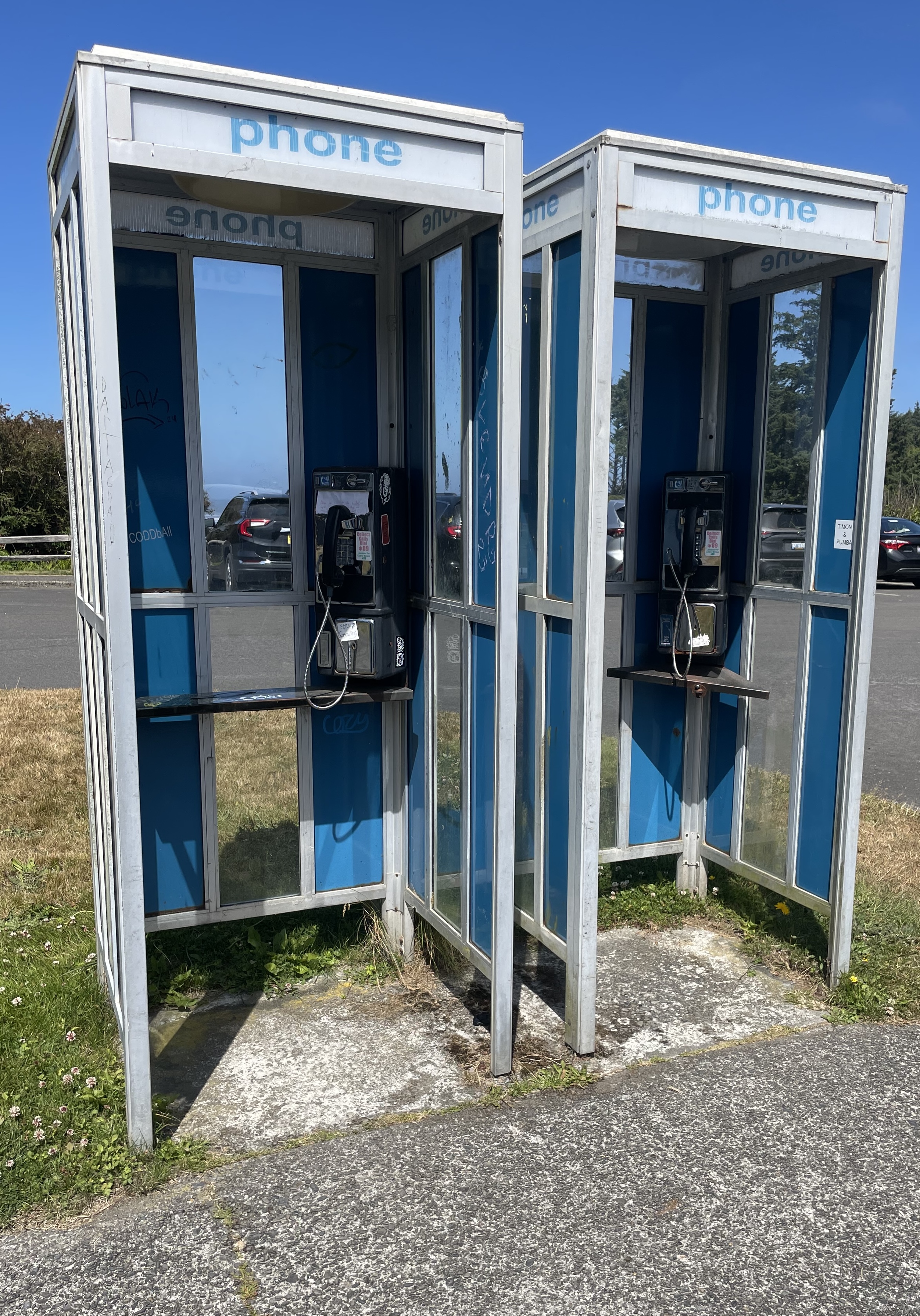
We found these phone booths. From a distance, they look to be operational.
This informative video shows that they have been taken out of service.
We pulled over and drove through the parking area at Ruby Beach. We did not leave the car. The location was very crowded. Spring, fall and offseason visits are probably best at Ruby Beach.
 About 80 miles up the road, we arrive at Kalaloch Creek:

 Westport, WA is a pedestrian-friendly town with easy access to views of the working waterfront.
The Marina
 A genuine seaport town.


 Maritime culture just outside the marina:


Observation Tower
When you’re done at the marina, walk up to the public viewing tower and take a look:
 Information on the tower is here.
The tower has a live web cam showing views in all directions.
A fixed cam at Westport Maritime Museum also shows a view of the marina.
Both cams can be seen here.
Below: A very nice image identifying local coastal features.
Source/credit: City of Westport

The Cove
The Westport Light Trail begins at the base of the observation tower and will take you to the cove.
Walk the cove towards the state park and look for views of an international maritime culture.
An early March 2025 view:
 At the state park, you may continue on the Westport Light Trail all the way south to W Ocean Ave. From there, it’s a short walk to the lighthouse. Google maps shows all of the trail here.
 Look for surfers at the jetty.

 Look for dog friendly beaches south of the jetty.

 Finish up the Westport Light Trail and climb to the top of the lighthouse.

 When you finish at the lighthouse you may head back to the beach on W Ocean Ave.

 Head south for more dog friendly beach and plenty of sand dollars.

 Stay overnight?
Two personal blogs:
Frank Hotels Westport – Good Experience – Again
These folks operate more than one location in town:
Frank Hotels web page is here.
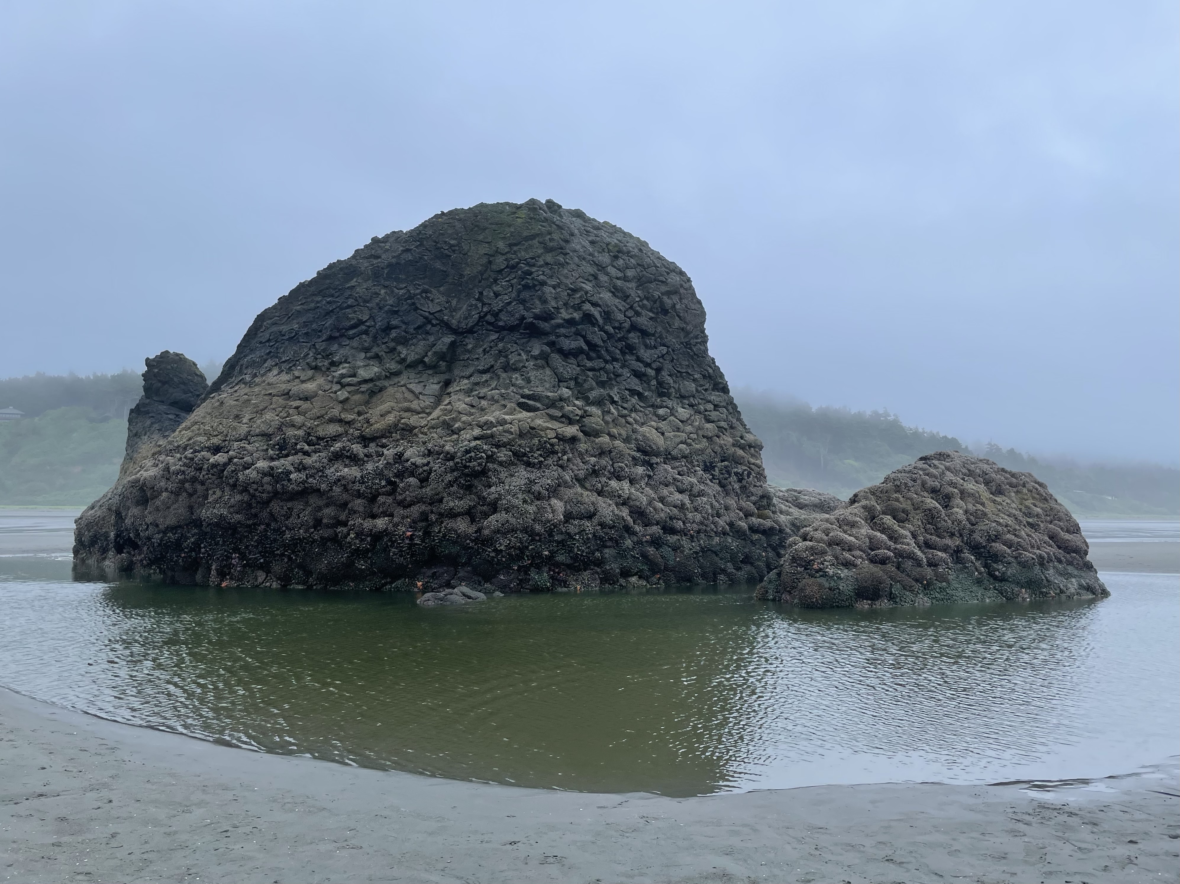 Above: Copalis Rock
We parked near the public access road at Roosevelt Beach and walked out to Copalis Rock and back. We were on foot for about two hours.
We were happy to be able to walk on all sides of the rock.
There was a heavy mist during much of the walk.
We were out recently on June 20th. The weather was drier, but the tide was not as low:
Roosevelt Beach to Copalis River
No sun visible during today’s outing.
 At low tide, there is a scattering of large rocks that are visible on and offshore.


 Heading back:


 Wildlife for today:
We saw a River Otter near the rock. We saw at least one Bald Eagle.
I went out toward the surf and saw something larger than a Harbor Seal swimming near the shore.
Was it a Sea Lion? Was it an Elephant Seal?
Not sure. Here is a look at several possibilities.


 Above: Copalis Rock
We parked near the public access road at Roosevelt Beach and walked out to the river and back. We were on foot for just under three hours.
May be tricky to keep feet dry while crossing Boone Creek.
Dog Friendly
 Nice views of the rocks


 Airport is between Copalis Rock and the river:


 Near the mouth of the Copalis River:
 A really nice walk.
 Earlier this month, we walked out to the south side of the river:
Local info:
Sea Kayak – Copalis River Spit
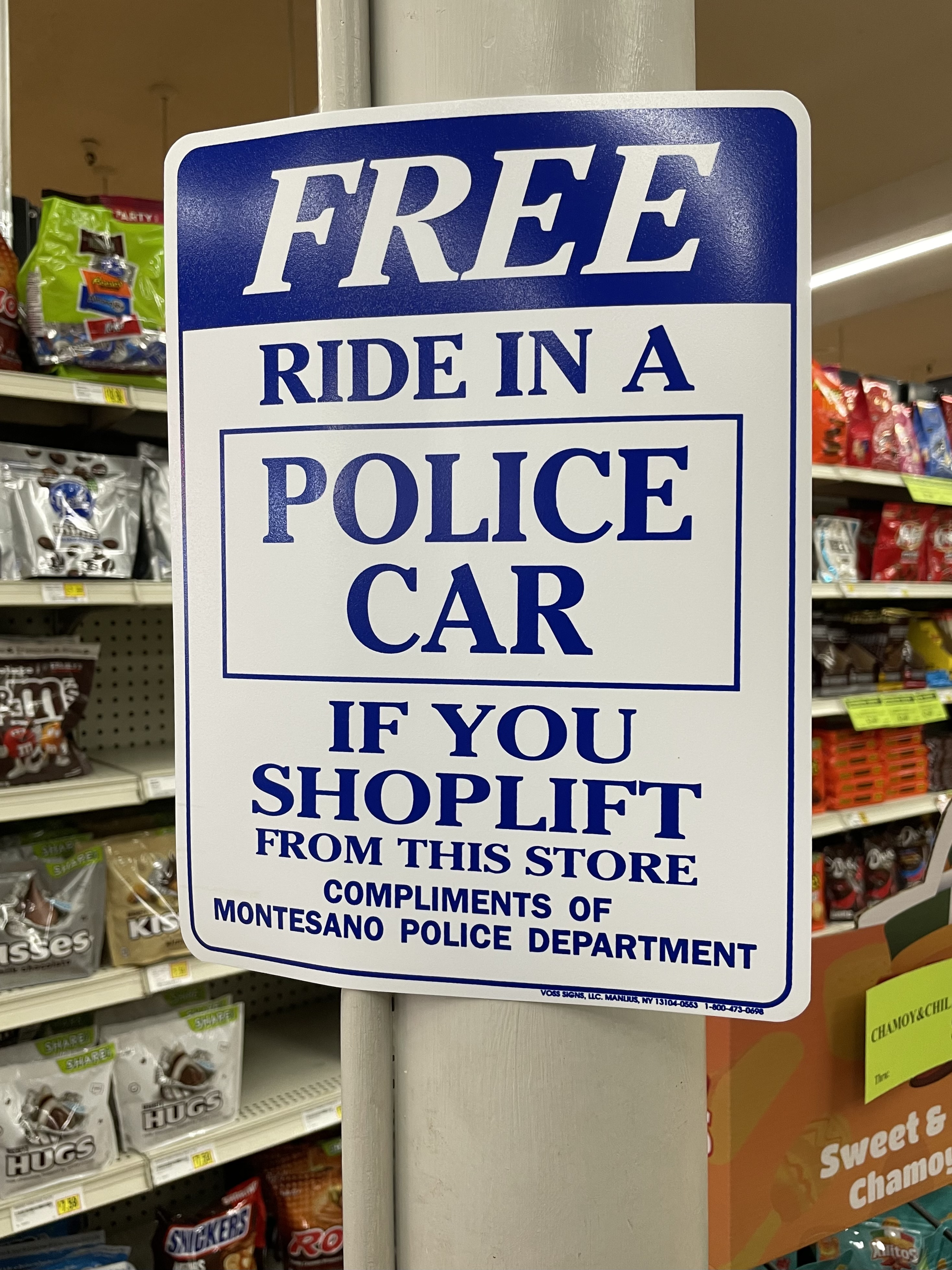 We made a quick stop at the grocery store in Montesano, where we saw the sign above.
Montesano seems to have several old school restaurants. We have not yet visited one.
We will stop again at the grocery store.
Possibly of interest:
 Photo above:
Working Waterfront – Westport, WA
A genuine seaport town – sending the message that the ways of the last century are best when managing public safety and a modern society. Don’t bring your Whidbey crap here.
 South of Union, Washington.
 The parts of WA that are in no hurry to change are my favorites.
Looking out over Mystery Bay:


 Years ago:
 Nordland
 Trip report:
We walked around the north end of the point and towards Port Townsend. We saw a sea lion on the beach and one swimming near the shore. We saw a whale offshore and heard it come up to breathe on occasion for an extended period of time.
Sound was traveling well over the water. We could hear the ship below approaching at a good distance.
 It passed close enough to tell it was flying the flag of Panama.
 Several sites on the web offer info on ship locations.
Ship above is WHISTLER
Click image once or twice to show detail.
Below:
We are looking towards Point Wilson.

 Various small crabs were out and moving over the sand near the rocks.

 Below:
Sea lion can be seen in the upper right and moving to the right.
 Click image once or twice to show detail.

 A variety of rocks and driftwood are part of the scene.
 Approaching the beach:

 Calm & quiet:
 Local history here. More local info here.
Possibly of interest-
Several years of beachcombing:
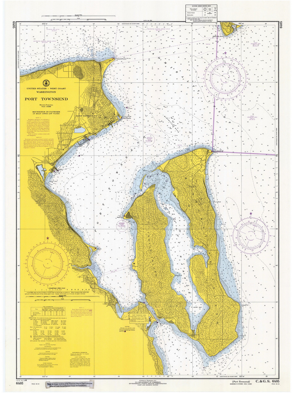
Local papers often use the redundant “Port Townsend Bay” when describing sailing races, etc. at Port Townsend.
The proper name for the body of water is: Port Townsend. Check a navigation chart.
The body of water was named before the town existed.
 Views from our recent round trip ferry ride.
Above: Leaving Port Townsend


 Below: Point Wilson Light
 Below:
Leaving Keystone

 Birds are active:


Coupeville/Penn Cove is on the eastern shore of Whidbey Island-no ferry link to Port Townsend exists there.

 Point Partridge
 Uptown Pub – Port Townsend
A beautiful sunny day on Thursday. Stopped in for a break after traveling up from the Washington Coast/North Beach area. Some time to spare before catching the ferry to Keystone. Nice pub atmosphere. Great service. My wife is the designated driver on this day.


 Libbey Beach area.
 Image above – A different/more recent outing, further south in Olympic National Park at Kalaloch South Beach.
News from a high school buddy that someone we knew back then (late 1970s) has passed away.
This brought up a memory from that time.
We lived in Kitsap County as teens. On two occasions in the mid/late 70s we hitchhiked with backpacks from home out to Lake Ozette.
This area is in the northern coastal section of Olympic National Park. The photo at the top of the page was taken in a separate coastal section of Olympic National Park located to the south.
My memory says there were 4 of us on one trip and two of us on another. For the larger group, we split up for hitchhiking into two groups of two.
From Lake Ozette, we walked out to the beach, then about 17 miles south to Rialto Beach. We then hitchhiked back home.
Still have the pack I used then:


 Stove too:

 Here is a detailed look at the hike:
Driftwood campfires on the beach every night.
On one of our return trips, the ride we caught somewhere on the Olympic Peninsula was headed to Bremerton. We got off there, then walked on the Bremerton ferry to Seattle, then the next ferry ride back home to the 1970s version of Bainbridge where we lived.
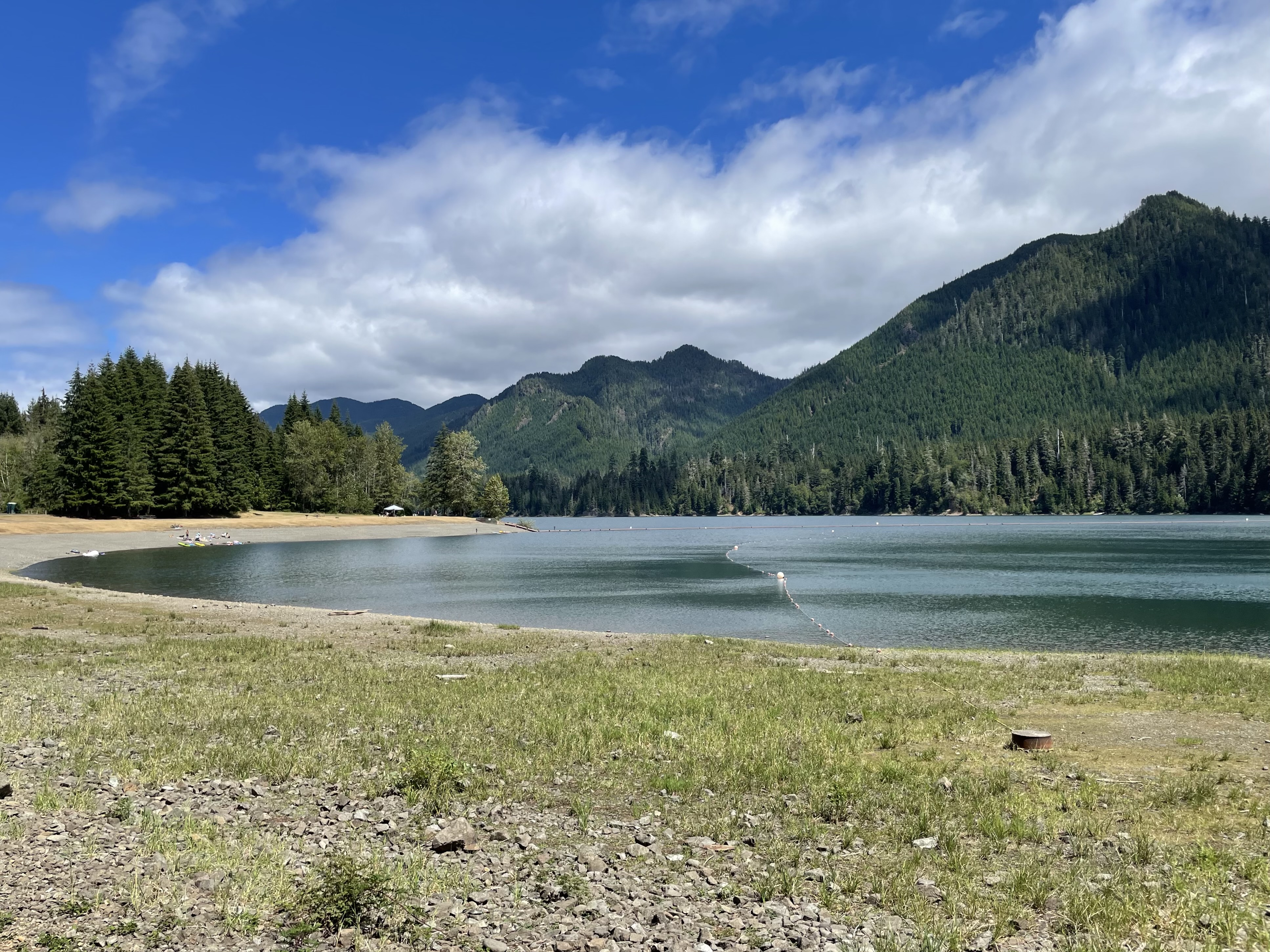
 Drove out today, to take a look.
Above: a view looking out along the dam, which can just be seen to the far right.
Below: a view looking over towards the beach/day use area.
 Local info here:
By Douglas Scott
Tacoma Public Utilities
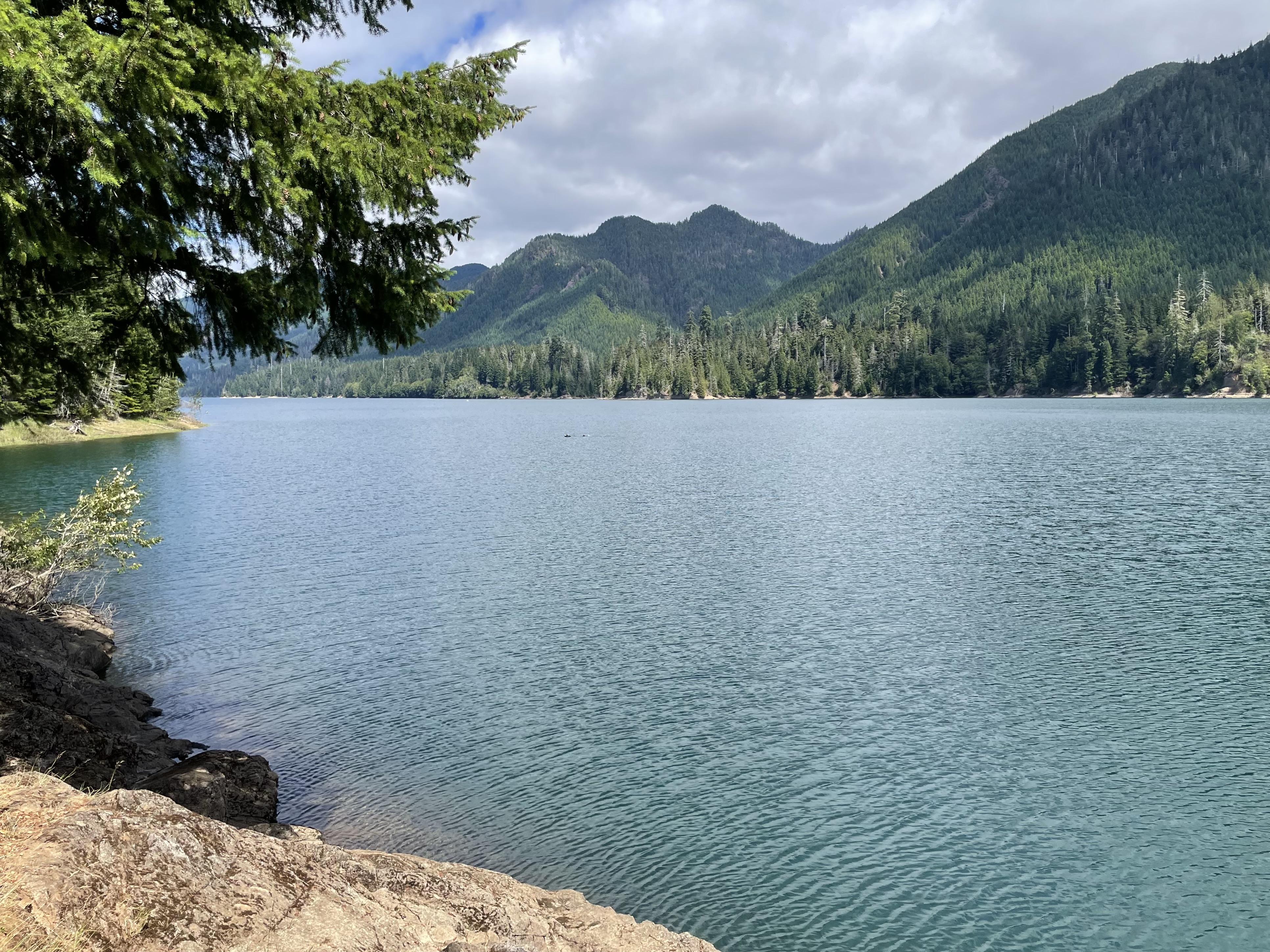
 We saw several people and families out enjoying the water today.
During some part of the year, it is cold out there:
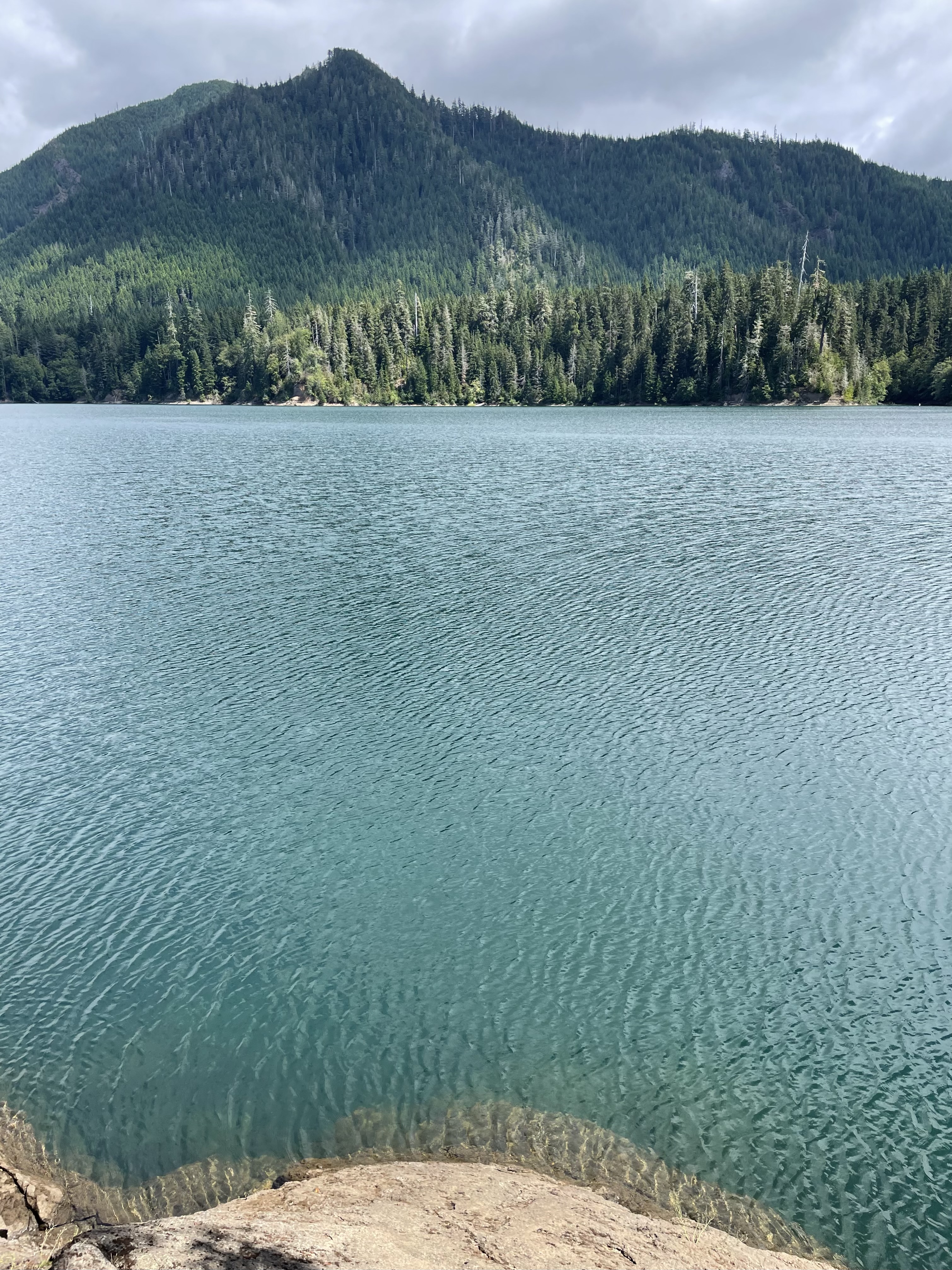
 Plenty of woods to walk in:


 Enjoyed it.


 Looking towards Nordland


